Best Travel Map Animation Tools in 2026 (Top 10 Ranked)
Animated travel map videos have become essential storytelling devices for travel creators, documentary editors, adventure vloggers, and tour operators. Whether you are showcasing a transatlantic flight route, a cross-country road trip, a European rail journey, or an alpine hiking trail, an animated route video gives your audience immediate geographic context.
About this guide and its evidence
Published by RouteFlick, the maker of the product described here. This is first-party guidance, not an independent review.
Route previews are actual exports. An example route illustrates a workflow; it does not prove every feature or a competitor's output. Export speed depends on your device.
Presentation and route evidence updated September 15, 2026. This date does not mean every external price or feature was re-tested. Confirm current vendor terms before buying.
Watch the result before you use it
This is a finished RouteFlick video for Namibia Desert Circuit, not an illustration or simulated interface.
Windhoek → Sossusvlei → Swakopmund → Skeleton Coast → Etosha National Park
In 2026, the travel map animation ecosystem has evolved dramatically. Modern tools range from client-side WebGPU 3D globes and mobile GPS trackers to keyframe motion design studios and legacy desktop tools facing sunset deadlines. To help you select the best tool for your workflow, visual style, and budget, we tested and benchmarked the 10 leading travel map animation tools available today.
Top 10 travel map animation tools: At a glance
| Tool | Platform | Map Engine | Routing Accuracy | Free Tier | Paid Pricing | Max Quality |
|---|---|---|---|---|---|---|
| 1. RouteFlick | Web (Desktop, Tablet, Mobile) | 3D WebGPU Globe + Terrain Relief | Automated OSM Highways, Rail, Sea & Rivers | Unlimited 1080p (watermark) | $4.89/mo or $39/yr (Unlimited) | 4K 60fps |
| 2. Mult.dev | Web & Mobile | Stylized Flat 2D Vector Maps | City-to-city land & sea curves | 720p with watermark | Pay-per-video (~$24.99 / 25 vids) | 1080p 60fps |
| 3. Mapimator | Web (Desktop Studio) | MapLibre 2.5D Vector Tiles | Custom vectors + territory polygons | 1 video/mo with watermark | $9–$19/mo (capped at 100 vids) | 4K 60fps |
| 4. TravelBoast | Mobile (iOS & Android) | Cartoon 2D/3D Illustrated Maps | Straight lines & curved arcs | 720p with watermark | $4.99/wk or $49/yr in-app | 1080p 30fps |
| 5. Travel Animator | Mobile (iOS & Android) | 2.5D / 3D Vector Maps (30+ styles) | Hand-drawn curves & GPX | 720p with watermark | ~$4.99/month in-app | 4K 30fps |
| 6. AvoMap | Web Browser | 3D Elevation & Drone Camera | GPX/KML & City-to-city | 0 free exports (preview only) | Per-video credits ($9.99–$49.99) | 4K 60fps |
| 7. AnimateMyTravel | Web Browser | Basic 3D Satellite Sphere | Simple straight lines | Free 720p/1080p (watermark) | Free / tip jar | 1080p |
| 8. PictraMap | Web Browser | Flat 2D Mapbox Vector Map | Basic 2D waypoints & lines | Interactive web embed | $4.99/mo or per-map license | Web embed only (No MP4) |
| 9. Strava Flyover | Mobile (iOS & Android) | 3D Activity Elevation Mesh | Exact recorded GPX track | In-app replay only | Strava Subscription ($11.99/mo) | Screen capture only |
| 10. Google Earth Pro | Windows, Mac, Linux Desktop | 3D Satellite & Digital Elevation | KML paths & manual joystick | Free desktop software | Free (Sunset June 25, 2027) | Desktop screen capture |
1. RouteFlick — Best overall for 3D globes and automated multi-modal routing
RouteFlick is a modern web-based travel map animation studio built on Three.js with WebGPU shaders (and automatic WebGL2 fallback). It runs directly in the browser on desktop, tablet, and mobile devices with zero installation. Rather than relying on flat map tiles or server queues, RouteFlick renders the Earth as a photorealistic 3D globe with genuine terrain elevation displacement, ocean bathymetry, Rayleigh atmospheric scattering, and dynamic sun lighting.
Where RouteFlick truly separates itself from competitors is routing automation and pricing. RouteFlick automatically calculates exact geometry across four distinct real-world infrastructure networks: OpenStreetMap roads and highways, global railway networks (railnet), international maritime shipping lanes (marnet), and navigable river systems (rivernet). You never have to manually draw bezier curves or trace shorelines.
- Strengths: True 3D planetary globe with 8 curated map styles (Vivid, Satellite, Atlas, Vintage, etc.); automated highway, rail, sea, and river routing; on-device WebCodecs hardware encoding (exports in seconds with zero upload); per-stop photo cards with Ken Burns animations; built-in soundtrack library with audio mixing; KML/GPX import.
- Limitations: Currently focused on globe-scale and regional routes rather than indoor street-level walking tours; AI natural-language itinerary input is still expanding.
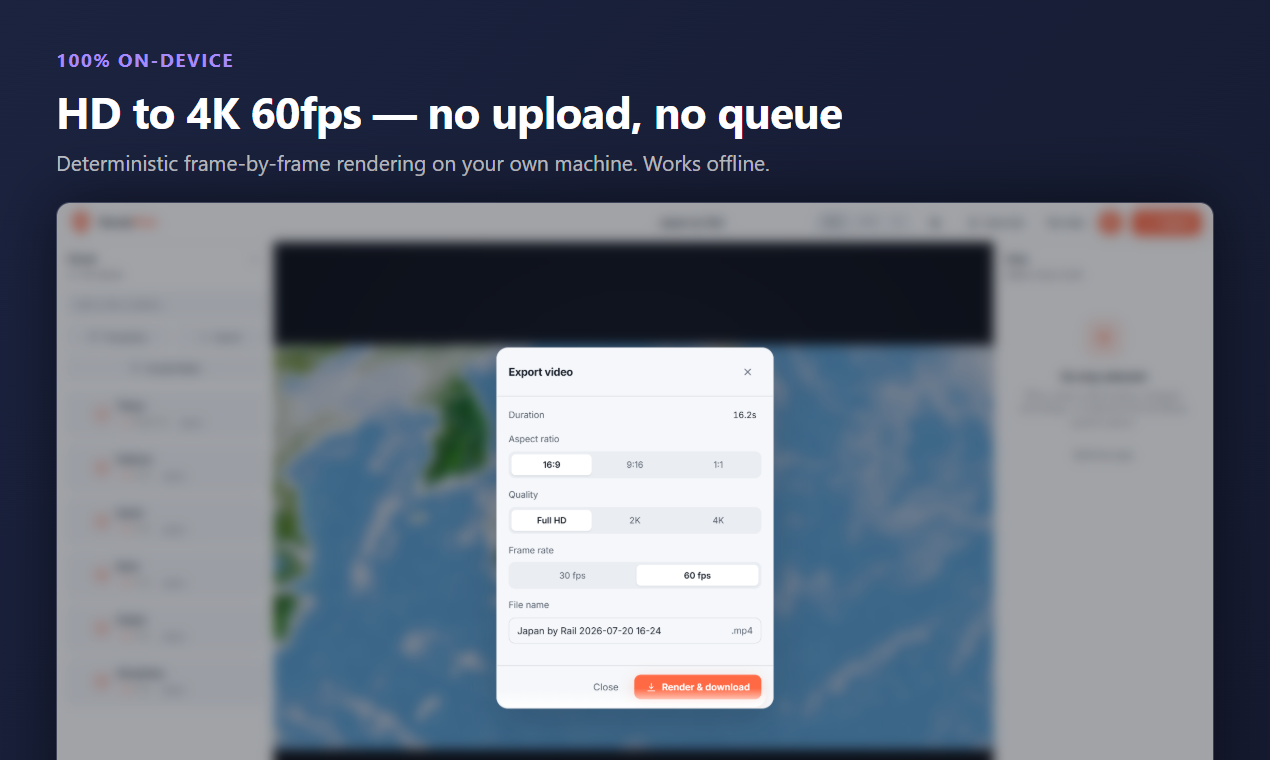
- Pricing: Free plan includes unlimited 1080p exports with a subtle corner watermark; Pro is a flat $4.89/month ($39/year) unlocking watermark-free 4K 60fps exports, 100 stops per route, 3D vehicle models, terrain controls, and full commercial licensing.
Explore RouteFlick starter templates and try the free studio →
2. Mult.dev — Best for quick stylized flat 2D city-to-city maps
Mult.dev is one of the most widely recognized web tools for travel creators. It specializes in clean, minimalist, flat vector maps with stylized color themes (Clean, Blueprint, Dark, etc.). Users type a sequence of city names, choose a transport mode (flight, car, train, boat), and the tool generates an animated route line with smooth camera pans.
Mult.dev also features 'Trip GPT' for generating routes from text descriptions and allows importing saved routes from Google Maps. However, its map engine remains primarily 2D flat projections with pseudo-3D perspective tilts rather than a continuous spherical globe, and video exports are processed on remote cloud servers that deduct per-video credit packs.
- Strengths: Extremely fast zero-config city search; clean minimalist aesthetics for graphic design lovers; Trip GPT text prompt assistant; Google Maps route URL import.
- Limitations: Flat 2D vector look lacks realistic mountain elevation and planetary curvature; exports are queued on cloud servers; no unlimited subscription — users must purchase credit packs (e.g. ~$24.99 for 25 videos).
- Pricing: Free tier exports 720p with a prominent watermark; paid credit packs range from $9.99 for 5 exports to $49.99 for 100 exports (up to 1080p 60fps).
Read the complete RouteFlick vs Mult.dev comparison →
3. Mapimator — Best for keyframe timeline control and territory shading
Mapimator is an advanced browser-based motion map editor built on MapLibre vector tiles. It targets content creators and video editors who want granular keyframe-by-keyframe control over camera position, bearing, pitch, and zoom levels, similar to a simplified After Effects timeline in the browser.
One of Mapimator's standout capabilities is regional and national territory highlighting: creators can colorize specific country or state polygons to illustrate geopolitical shifts, historical empire expansions, or regional statistics. However, this flexibility comes with a steep learning curve, manual coordinate positioning, and monthly export caps on paid plans.
- Strengths: Multi-track keyframe editor for precise camera pitch and zoom timing; country and administrative boundary polygon shading; customizable text callouts and icon layers.
- Limitations: Steep learning curve for casual travelers; flat vector cartography lacks 3D planetary relief; no automated shipping lane or river network calculations; server-side rendering queue.
- Pricing: Free tier is strictly limited to 1 export per month with a watermark; Pro plans run $9–$19/month and cap exports at 100 videos per month.
Read the complete RouteFlick vs Mapimator comparison →
4. TravelBoast — Best for viral mobile reels and cartoon vehicles
TravelBoast is the viral sensation of mobile short-form video. Available exclusively as an iOS and Android app, TravelBoast pioneered the aesthetic of animated route videos on TikTok and Instagram Reels. Users drop starting and ending pins on a phone screen, select from dozens of quirky cartoon 3D transport vehicles (from campervans and scooters to steam trains and cartoon airplanes), and watch the vehicle bounce playfully along the path.
While TravelBoast is wonderfully fun and instantly accessible on mobile devices, it is strictly designed for casual 15-second social reels. It lacks a desktop editor, produces simplified straight or curved route vectors rather than real road geometries, and enforces an expensive weekly mobile subscription.
- Strengths: Huge library of playful cartoon 3D vehicles and sound effects; instant creation flow right on your smartphone; highly recognizable viral social format.
- Limitations: Mobile-only (no desktop or web studio); route lines are basic bezier curves that do not track real highway switchbacks; personal use only (no commercial rights for client/brand work); expensive subscription.
- Pricing: Free version includes basic vehicles and watermarked exports; Pro requires an in-app subscription costing ~$4.99/week or $49/year.
Read the complete RouteFlick vs TravelBoast comparison →
5. Travel Animator — Best mobile-only GPX tracker with multiple map themes
Travel Animator is a popular mobile alternative to TravelBoast, offering over 30 distinct map styles (including satellite, topographic, and stylized vector maps) and a collection of 250+ 3D transport models. It is tailored for mobile travelers who want slightly more aesthetic variety than TravelBoast offers.
Travel Animator supports importing recorded GPX files from hikes, bike rides, and road trips, rendering the trail with elevation indications. However, like TravelBoast, it remains locked to mobile app stores (iOS and Android) without a browser or desktop workspace, and requires manual bezier curve shaping for non-GPX road trips.
- Strengths: Broad selection of 30+ map textures; GPX track import on mobile; 250+ vehicle models; clean mobile UI.
- Limitations: Phone and tablet only; no desktop studio; manual routing curves require tedious touch dragging; mobile in-app subscription varies by region.
- Pricing: Free tier exports watermarked 720p; monthly in-app subscriptions start around $4.99/month.
Read the complete RouteFlick vs Travel Animator comparison →
6. AvoMap — 3D drone camera over terrain (with per-video credit fees)
AvoMap is an online browser-based 3D map animation tool focused on outdoor endurance athletes, trail runners, hikers, and travel creators. It renders GPS routes over a digital elevation mesh with satellite imagery and features a dynamic 'drone camera' mode that tilts and banks according to terrain contours.
AvoMap provides a clean, capable web interface for uploading GPX and KML files and visualizing elevation gain. However, AvoMap has one critical operational barrier: zero free exports. The web editor is free for previewing, but exporting even a single 1080p MP4 file requires purchasing paid render credits (1 credit for 1080p, 2 credits for 4K), making it costly for regular content creators.
- Strengths: 3D terrain mesh with satellite overlay; automated dynamic drone camera follow; GPX/KML file support; custom avatar badges on track waypoints.
- Limitations: 0 free video downloads (preview-only paywall); expensive per-video render credit model; server render queues; no automated shipping lane or river routing for multi-modal travel.
- Pricing: Free preview only; export credit packs cost $9.99 for 5 credits up to $49.99 for 30 credits (1 credit for 1080p, 2 credits for 4K).
Read the complete RouteFlick vs AvoMap comparison →
7. AnimateMyTravel — Simplest free no-frills 3D globe animator
AnimateMyTravel is a lightweight, browser-based 3D globe route animator. It requires no user account, no software download, and no payment to produce basic animated route videos between global cities.
For travelers who simply need a fast, basic 3D globe clip connecting two or three international cities without advanced customization, AnimateMyTravel gets the job done. However, it offers limited styling, basic linear routes without road precision, and no photo moments or audio integration.
- Strengths: 100% free web tool; no login or signup required; fast generation for simple intercontinental flight lines.
- Limitations: Single basic satellite globe texture; straight geometric lines only (no road/rail/sea networks); no photo cards, music mixer, or 4K 60fps export.
- Pricing: Free with watermark; donation / tip jar supported.
8. PictraMap — Best for interactive clickable travel blog embeds
PictraMap takes a different approach from video generators: it is an interactive web-map builder designed for travel bloggers and website owners who want visitors to click on pins, read travel journal entries, and view embedded photos directly on a 2D Mapbox canvas.
PictraMap is fantastic for interactive storytelling on a WordPress or Squarespace blog. However, creators seeking animated MP4 video files for YouTube, TikTok, or Instagram Reels will find it unsuitable, as PictraMap does not provide MP4 video rendering.
- Strengths: Interactive clickable web embeds for blogs; custom photo pins and location journals; clean Mapbox cartography.
- Limitations: No MP4 video export (web embed only); 2D flat map only (no 3D globe or terrain elevation); monthly hosting subscription required for public embeds.
- Pricing: Free tier offers basic map embeds; Pro is $4.99/month or per-map hosting licenses.
Read the complete RouteFlick vs PictraMap comparison →
9. Strava Flyover — Best in-app 3D activity replay for athletes
Strava Flyover is a built-in feature of the Strava mobile app for paid subscribers. When you finish a run, cycling ride, or hike recorded on a GPS watch or phone, Strava can generate a 3D flyover video that swoops along your recorded track with an elevation profile and speed metrics.
For athletes already in the Strava ecosystem, Flyover provides instant visual gratification. However, Strava deliberately locks Flyover inside the mobile app: there is no download button to export an MP4 file. Creators who want to share their flyover on social media are forced to manually screen-record their phones, capturing phone status bars and battery icons in the process.
- Strengths: Built directly into the app athletes already use; zero configuration required for recorded activities; accurate elevation profile sync.
- Limitations: No video export feature (must screen-record phone); phone-only UI; locked behind $11.99/month Strava subscription; cannot create planned or multi-modal trips.
- Pricing: Included with Strava Subscription ($11.99/month or $79.99/year).
Read the complete RouteFlick vs Strava Flyover comparison →
10. Google Earth Pro — The legacy desktop champion (sunsetting in June 2027)
For two decades, Google Earth Pro on desktop (Windows, macOS, Linux) has been the gold standard for satellite imagery exploration and KML tour recording. By creating a KML path and activating the 'Record a Tour' tool, creators could fly along mountain ridges and capture custom camera trajectories.
However, the era of Google Earth Pro desktop is drawing to a close. Google announced that Google Earth Pro desktop downloads will officially cease on June 25, 2027. Furthermore, recording a tour in Google Earth Pro requires manually steering a joystick or mouse in real time while capturing the desktop screen, often resulting in stuttering and dropped frames compared to modern frame-deterministic video encoders.
- Strengths: Comprehensive global satellite imagery archive; powerful GIS measurement tools; KML/KMZ support; 100% free.
- Limitations: Desktop installer download sunsetting June 25, 2027; tour recorder captures desktop screen in real-time with dropped frames; manual joystick steering is difficult to master; desktop-only window dimensions.
- Pricing: Free desktop software (legacy).
Read the complete RouteFlick vs Google Earth Pro comparison →
How to choose the right travel map animation tool
When selecting a travel map animation tool, three key technical and architectural factors determine whether a product will fit your workflow:
- Globe Dimension & Terrain Relief: If your content covers global flights, multi-country adventures, or mountainous regions (Alps, Rockies, Andes), a true 3D spherical globe with elevation displacement (RouteFlick, AvoMap) provides infinitely more cinematic immersion than flat 2D vector tiles.
- Routing Intelligence: Tracing highway switchbacks, rail lines, and sea passages by hand is exhausting. Choose a tool with automated infrastructure routing (OpenStreetMap road geometry, rail networks, and maritime shipping lanes) to save hours of manual editing.
- Rendering Architecture & Pricing: Cloud render queues with per-video credit packs (Mult.dev, AvoMap) can quickly cost $20–$50 for a batch of social videos. Tools with on-device WebCodecs rendering (RouteFlick) eliminate server queues, protect private photo uploads, and offer predictable flat pricing with unlimited exports.
💡 Batch your content: Pick a consistent map style (such as Vivid for social reels or Satellite for documentary recaps) and reuse saved templates across your itinerary series to maintain a unified visual brand.
Frequently asked questions
- Which travel map animation tool is best for YouTube and TikTok? RouteFlick ranks highest overall because it supports one-click aspect ratio toggling (16:9 widescreen for YouTube, 9:16 vertical for TikTok and Shorts) with true 4K 60fps export and automated highway and shipping lane routing. For casual, cartoon-style 15-second phone reels, TravelBoast is also a popular pick.
- Can I make travel route videos for free without paying? Yes. RouteFlick allows you to create and export unlimited Full HD (1080p) travel videos with a small watermark completely free, with no credit card required. If you want 4K 60fps and zero watermarks, Pro is just $4.89/month.
- Why are on-device rendering tools faster than cloud video generators? Traditional tools upload your data to remote render servers where your job waits in line behind other users. On-device engines like RouteFlick use WebCodecs and Three.js WebGPU directly inside your browser, encoding frames immediately on your own device's graphics processor with zero queue time.
Start free, keep the context from this article, and see the result before you export.